
Andover Room Map Collection
The Andover Room has a significant collection of single-sheet historical maps depicting Andover, neighboring Merrimack Valley towns and Essex County dating from the seventeenth century through current times. The collection includes a variety of types of maps including political, zoning,insurance and topographical maps. Researchers interested in understanding the history of geography, the built environment, political districting, open space and other aspects of the history of the Town of Andover will find many useful resources in the library's map collection. At this time, Memorial Hall Library's Andover Room Map Collection is neither cataloged nor digitized. Researchers, should refer to the MHL Map Collection Finding Aid and inquire about using our hard-copy maps at the Reference Desk.
Memorial Hall Library/Andover Room Map Collection Finding Aid
Access to Digitized Andover History Maps in Other Archives and Libraries
Other libraries and archives collect, catalog and host high-resolution digital images of historical maps of the Town of Andover. The Boston Public Library's Norman B. Levanthal Map & Education Center and The Library of Congress Map Division are two institutions that have committed significant resources to collecting and preserving maps that will be useful to Andover-area researchers. In many cases, these maps are available for download and printing in high-resolution TIFF and JPEG format. Unless otherwise noted, these maps are in the public domain and have no restriction on use. In some cases, maps are not available for download or reproduction, in which case researchers must seek permission from the holding institutions for use. As a matter of courtesy and standard practice, researchers should fully attribute credit to the holding institution of any maps used in their work. In cases where materials will appear in print, film or video broadcast, researchers should notify holding institutions of their use.
Boston Public Library/ Norman B. Levanthal Map Center Collection
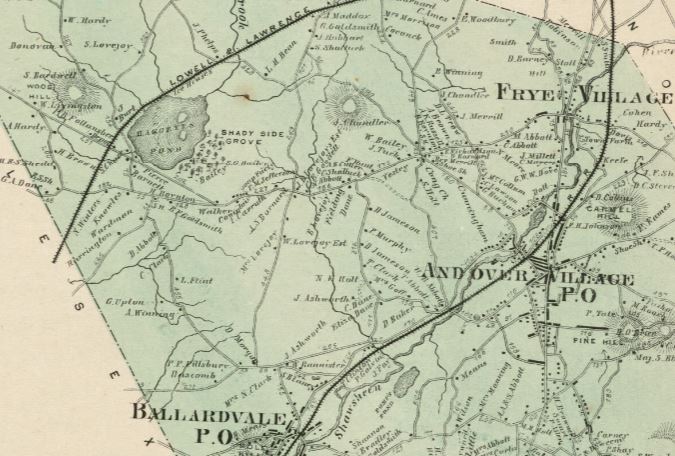
- Atlas of Essex County Massachusetts, 1884, Geo. H. Walker & Company
Harvard University Map Collection
- Plan of Andover Taken for the Town, Moses Dorman, 1830
- Map of the Town of Andover, Henry F. Walling, 1852
- Topographical Map of Essex County, 1856
Lawrence Public Library Digital Collections
- A Plan of the Town of Andover: taken by the subscribers, a committee appointed by the inhabitants of said town for that purpose agreeable to resolve of the General Court of June 18th one thousand seven hundred and ninety four. (1794) Moses Abbott, John Farnum Surveyors
Library of Congress Maps Division
- Andover, 1852
- Sanborn Fire Insurance Map from Andover, Essex County, Mass, 1892
- Sanborn Fire Insurance Map from Andover, Essex County, Mass, 1896
- Sanborn Fire Insurance Map from Andover, Essex County, Mass, 1906
- Sanborn Fire Insurance Map from Andover, Essex County, Mass, 1911
- Sanborn Fire Insurance Map from Andover, Essex County, Mass, 1917
- Sanborn Fire Insurance Map from Andover, Essex County, Mass, 1923
- Sanborn Fire Insurance Map from Andover, Essex County, Mass, 1930
- Sanborn Fire Insurance Map from Andover, Essex County, 1949
Massachusetts State Archives
- Plan of Andover, 1795
- Plan of Andover, 1830, Moses Dorman
Massachusetts State Library Digital Collections
National Archives Map Collections
National Aerial Photography
Phillips Academy Archives and Special Collections
- A Plan of Andover Taken for the Town, 1830, Moses Dorman
- Andover, 1880
- Andover Village, 1880
- View of Andover, Massachusetts 1882, O.H. Bailey & Company.
- Phillips Academy, School Limits, circa. 1955
- Phillips Academy Maps and Plans on Flickr
Salem State University Archives and Special Collections
- Essex County, Walling & Gray, 1871
- Map of Essex County, Mass, 1872, D.G. Beers & Co.
Southern Essex Registry of Deeds
These links are not direct, permanent links to the maps. From the Southern Essex Registry of Deeds website's left-hand navigation bar, select SEARCHES>ATLASES
- Andover Village, Plate #24 (1906), L. J. Richards & Company Cartographers
- Andover Village, Plate #16 (1926), L.J. Richards & Company Cartographers
- Shawsheen Village, Plate #17(1926), L.J. Richards & Company Cartographers
- Ballardvale, Plate #22 (1926), L.J. Richards & Company Cartographers
Town of North Andover Clerk's Office
United States Geological Survey (USGS) Historical Topographic Maps
The USGS has been issuing topographic maps of the Lawrence metropolitan area since 1886, just seven years after the founding of the federal agency. The USGS Historical Topo Map Viewer linked here: https://ngmdb.usgs.gov/topoview/viewer/#4/40.01/-100.06 provides access to the following high resolution maps for viewing, downloading, printing and overlay applications. Lawrence-area topo maps from the USGS depict significant natural and artifical features of Lawrence, Andover, North Andover, Tewksbury, North Reading and other bordering towns for the following years: 1886, 1888, 1893, 1918, 1943, 1944, 1948, 1955, 1956, 1958, 1961, 1966, 1984, 1987, 1988, 2012, 2015, 2018 and 2021.
Works Progress Administration Land Use Maps
Topography, Town of Andover, 1939
Land Utilization, Town of Andover, 1939
Soil Classification Town of Andover, 1939
Roads and Buildings, Town of Andover, 1939